Bikepacking from Seattle to Ipsut Creek Campground
Ipsut Creek, located in the northwest corner of Mt Rainier National Park , is a former car campground that was transformed into a backcountry camp for hikers and bikers after a massive flood washed out a section of Carbon River Road in 2006, forcing the Park to permanently close the last five miles to cars. Today, it's a great destination for an overnight bikepacking trip from Seattle. The 75-mile ride begins with fifty miles of paved trail along the Green, White and Puyallup Rivers before transitioning to twenty miles of lightly-trafficked country roads and highways that lead into the Park. The final five miles to the campground are on the remnants of the Carbon River Road beyond the closure, through old-growth forest and within earshot of the Carbon River. The road is dirt and gravel with plenty of rocks and a couple of major washouts where you may need to walk your bike, but it's not hard to negotiate most of the road if you have at least 28mm tires.
The total elevation gain is a very manageable 3,000 ft. and that comes mostly in the form of a steady, gradual climb once you leave the flat trails in South Prairie. However, there are two steep, winding climbs of 300-400ft - including moderate traffic - to negotiate. Even these parts are relatively straightforward if you are cautious and aware of your surroundings.
Because of the lower mileage and elevation, the amount of time on paved trails or car-free roads, the relative closeness of food and supplies, plus the campground amenities, this is a perfect ride for beginners who want to get a taste of bikepacking relatively close to Seattle.
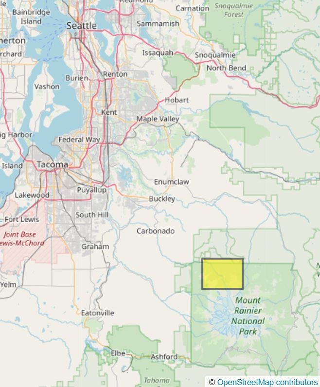
Ipsut Creek area (in yellow), about 75 miles southwest of Seattle
When to Go
Ipsut Creek Campground sits at an elevation of roughly 2300 feet, which means it melts out a little earlier than the rest of the park - typically in late May or early June. My favorite time to go is at the end of June, when there's a lot of daylight but the summer crowds haven't descended on the park yet. Because of the lower elevation, it's possible to make this trip as late as November. Of course, check conditions first. For the same reasons, I prefer weekdays to weekends; you'll find substantially less traffic on the roads and more available campsites.
Permits
A stay at Ipsut Creek Campground requires a wilderness permit, but they are usually easy to get early in the season. You must pick them up in person at the Carbon River Ranger Station - which is along the route, about 7.5 miles from the campground - and the hours can be short, even in the summer. Check the Park's operating hours here. When I went one June, they were only open until 4pm. I recommend a call the ranger station to confirm the hours. You may also be able to arrange for them to leave your permits out if you don't make it by closing. (There was no cell phone coverage when I went, and while your experience may vary, I recommend calling before you leave Carbonado)
Route
This route starts from Seattle at the north end of the Green River Trail and heads directly south through Kent, Auburn, Sumner and finally Orting before winding it's way toward the less-visted northwest corner of Mt Rainier National Park. As shown in the map, it follows the river valleys most of the way, which keeps the elevation gain to minimum until about 50 miles in.
Seattle to Sumner Link Trail
The route begins just below South Park at the northern end of the Green River Trail in Cecil Moses Memorial Park. There's a parking lot here, but you don't want to leave your car there overnight. If you're coming from northern parts of Seattle, you can reach the trailhead by crossing the Spokane Street Bridge into West Seattle and taking the Duwamish Trail to South Park and on to the trail.
Follow the pleasant Green River Trail for 6 miles as it winds through Tukwila and Fort Dent Park until you reach the junction with the Interurban Trail just beyond the soccer fields. There will be a map kiosk and clear signage. Turn left at the sign and cross over the river. The trail will wrap behind the fun center and then head up and under 405. The underpass can be a little tricky to find; it's crosses the freeway east of Interurban Ave, above street level. You shouldn't end up on Grady or Interurban Ave.
Don't expect a lot of scenery on the Interurban Trail. It follows power lines along the former route of the Interuban Streetcar; plenty of train tracks as well. While not pretty, it's a direct connection between Renton and Pacific, passing through Kent and Auburn. The route is easy to follow. Expect the trail to be a little rough for the last 0.5 mile segment beyond Algona.
At the end of the trail, turn left (east) onto 3rd Ave SW then right (south) at Milwaukee Rd. When Milwaukee ends after a few blocks, make a left and then a right onto Valentine. Continue south on Valentine on a wide bike path for 0.5 mile. Turn left onto 8th St E. (This is a busy intersection; it's best to use the crosswalks here.)
As you start to head east on 8th, the road narrows at a short bridge over the White River. There's no shoulder, so bicyclists will need to take the lane. I recommend stopping at the pullout right before the bridge, waiting for a gap in traffic, and then crossing. As you can see in Street View --add link--, it's not much of a challenge.
Once across the bridge, continue west on 8th past 140th and 142nd to the start of the Sumner Link Trail, which heads south.
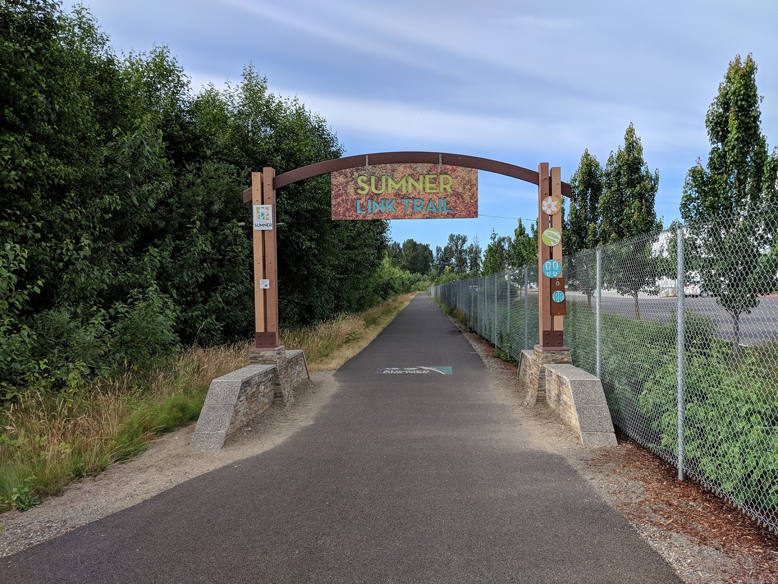
Start of the Sumner Link Trail
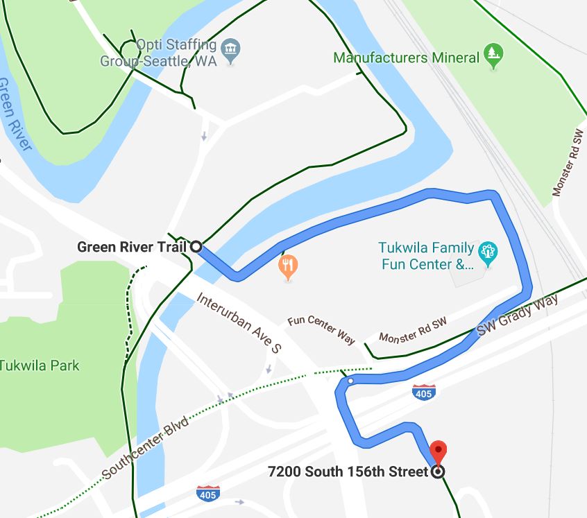
Route under 405 to Interurban Trail
Sumner Link Trail to Carbonado
The Sumner Link Trail winds along the White River for 5 miles, ending at East Main, just north of the Puyallup River crossing. Once over the river, continue SW on Main for 0.5 mile, then turn left onto Shaw. Take Shaw another 0.5 mile to Pioneer where the Foothills Trail begins. The trail runs east along Pioneer, on the north side of the street, and then breaks off at 80th. There's a trailhead with a restroom a short distance later.
The Foothills Trail heads south for about 7.5 miles before arriving in Orting, the largest town you'll pass through after leaving Auburn. There are several places to eat, a grocery store, motels, and a bike shop. The route is easy to follow, and well-marked. From Orting, the trail follows the Carbon River as it bends to the NE towards South Prairie. It's another 7.5 miles on the flat, wide trail till South Prarie. There's a nice coffee shop right along the trail and a gas station/mini-mart.
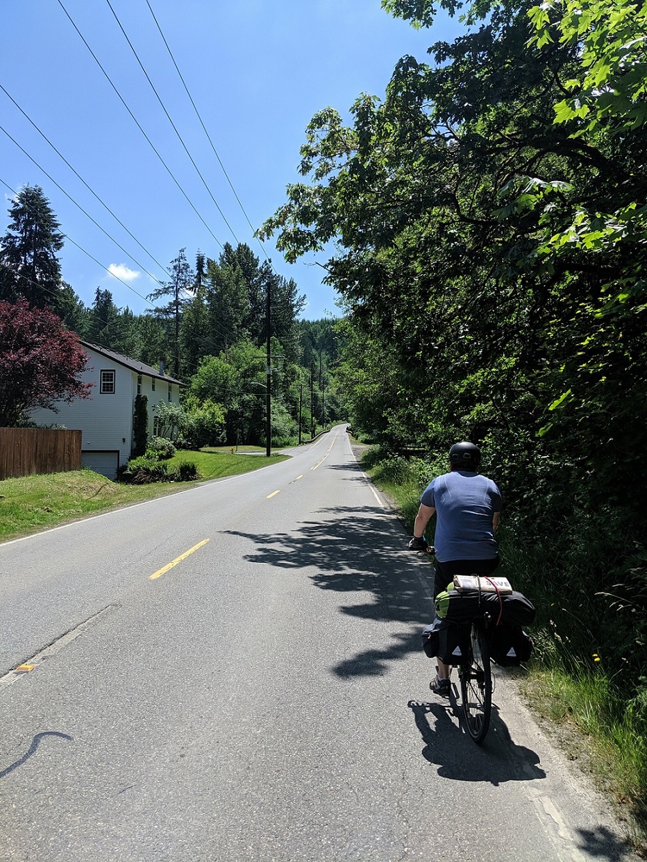
Leave the trail and turn right onto Emery Ave S. When it runs out in two blocks, take a left onto 3rd St SE which becomes A.B. Tubbs road at the start of the hill. Climb about 400 ft up and follow the road for 3 miles as it turns into Johns Rd and heads into Wilkeson. The traffic is generally light, but be careful on the sharp curves of the climb and when you merge with 165 near the end. In Wilkeson, you'll find a few places to eat and the last grocery store before the campground.
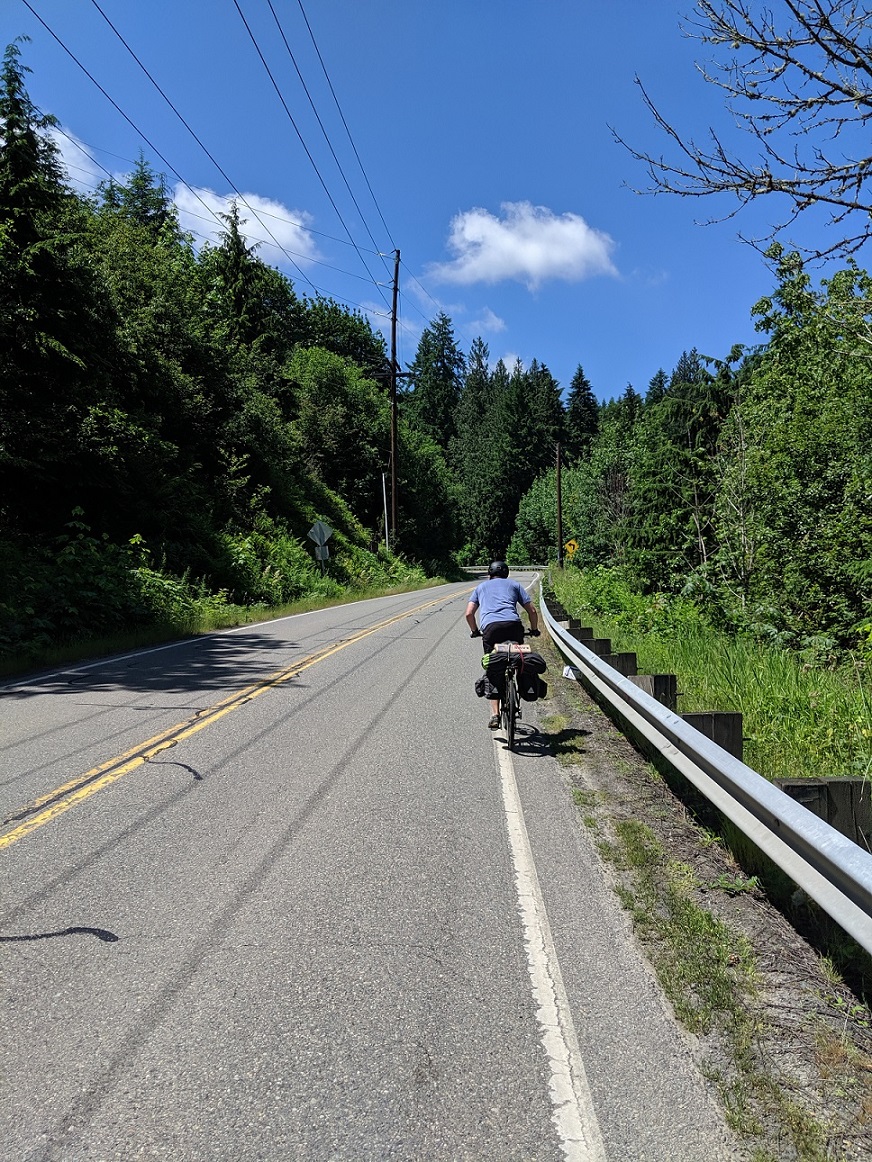
The climb out of Wilkeson on 165 is probably the sketchiest part of the whole ride. And it's really not bad, but you need to be careful. The route winds up about 300 ft over about 1 mile and there are sharp curves, meaning little visibility for cars behind you. I typically ride wide in the lane until a car approaches, so they can see me as early as possible, then move over. There's guardrails and no shoulder so you need to just power through this section until the junction with 178th St. E where you can pull off and rest. Then it's just 0.2 miles to the junction with Wilkeson-Carbonado Rd, a quieter way to get to Carbonado if you want to avoid 165 for a bit.
Approaching the climb.
Climbing out of Wilkeson.
Carbonado to Ipsut Creek
From Carbonado it's a mostly flat, three-mile ride along 165 to the Fairfax Bridge. The bridge, which opened in 1921, has been paved since the photo and rides a lot smoother now. There's a pullout beyond the bridge where you can park your bike for a rest or to take photos.
One thing to note: there's a roughly 2 mile stretch of the Foothills Trail that runs along 165 just after Carbonado to the bridge and the farther beyond. There's a very clear sign at the trailhead; it's easy to spot. The trail is unimproved, but it's generally wide, packed dirt and easy to ride. See this video for a good example of what conditons are like. Personally, I just ride on the road because traffic conditions are light and you can make faster time on the road.
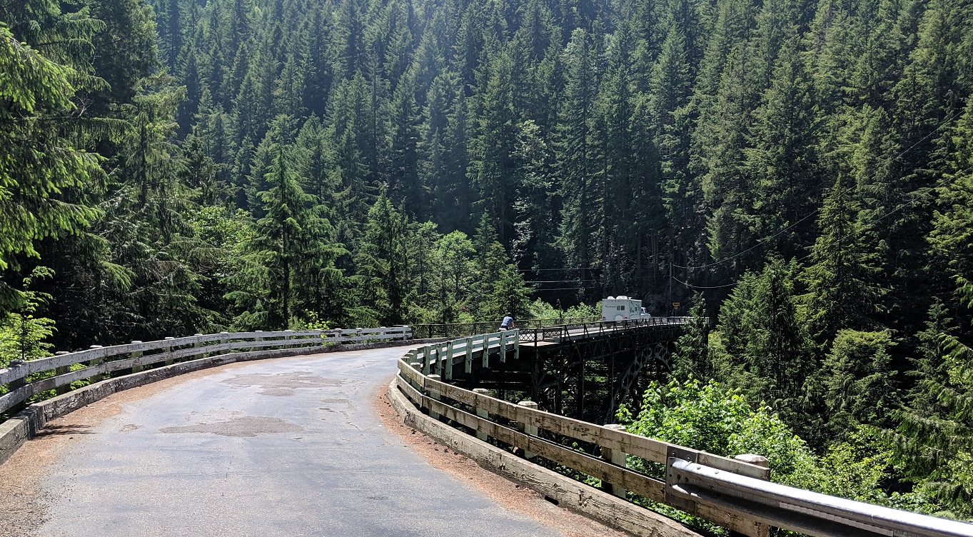
Fairfax Bridge
Just beyond the bridge, you'll reach the turnoff for Carbon River Road. Leave SR 165 - which climbs nearly 4,000ft over the next 15 miles before ending at Mowich Lake - and bear left onto Carbon River Road.
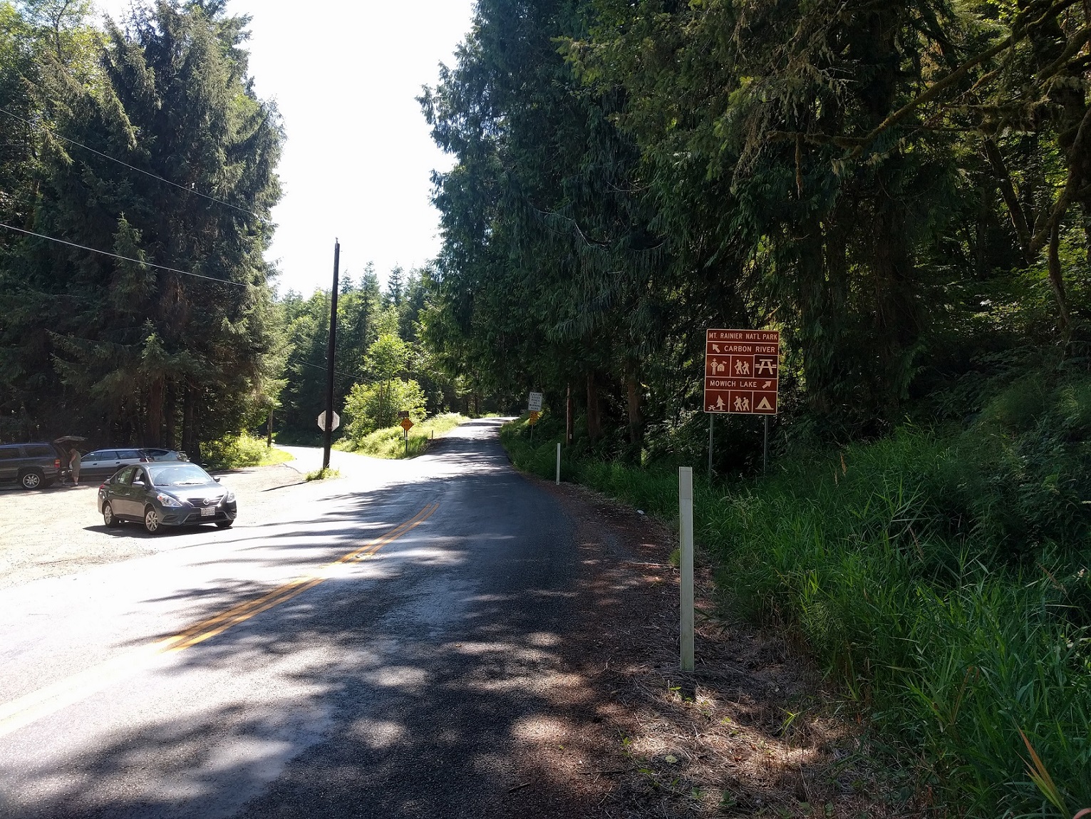
Junction with Carbon River Road.
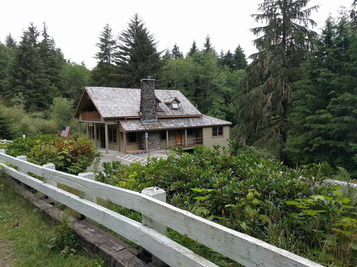
Carbon River Ranger Station.
After five miles of steady climbing on Carbon River Rd, you'll reach the ranger station. Get your permits here and then continue on to the trailhead at the end of the paved road, 2.5 miles farther east. (Again: the ranger station is lightly staffed. Make sure to check the hours and arrive before they close, or else call ahead to see if they will leave the permits outside for you. When I went, the station closed at 4pm)
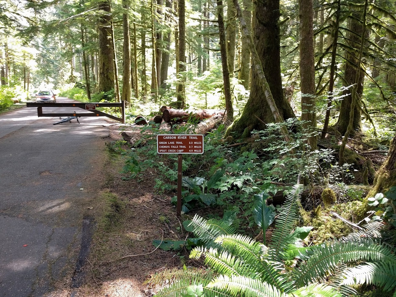
The start of the road to Ipsut Creek.
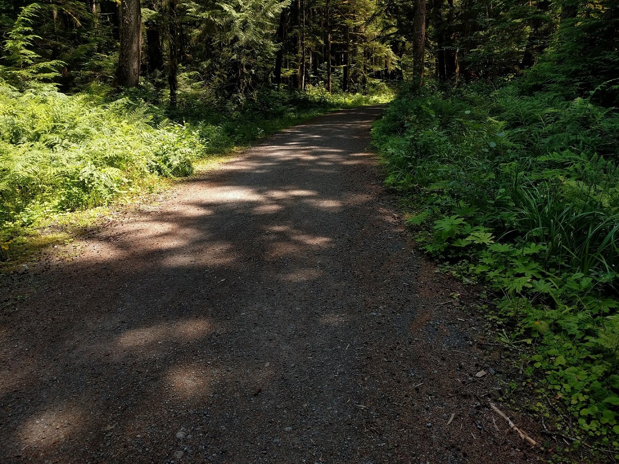
The road starts out in great condition, but eventually turns rougher.
The road to the Ipsut Creek Campground is smooth at the beginning, but gets rougher and you will probably need to hike-a-bike over a couple of the washouts, but you should be able to get through this on 28mm tires, or even a regular road bike if you're ready to walk in places. (I wouldn't recommend it though).
The road ends at the campground. Ipsut Creek is a former car campground, so there are large campsites, bear lockers, picnic tables, and vault toilets. Unfortunately, fires are not allowed. At the far east end of the campground there is a locked and shuttered patrol cabin. Beyond that is a trailhead that leads to several trails, including the Wonderland. Follow the trail about 0.2 miles to Ipsut Falls for fresh water. (You'll cross a log bridge to get there.)
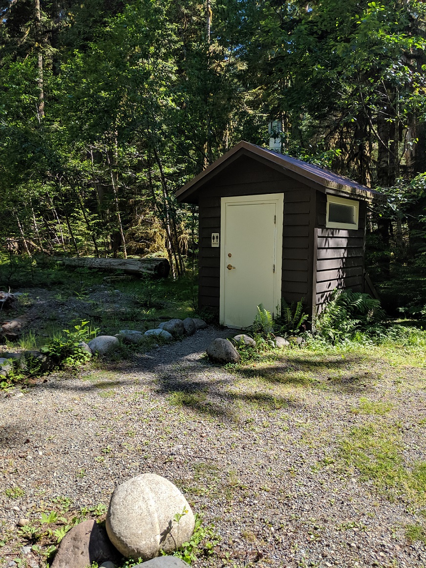
There are two vault toilets.
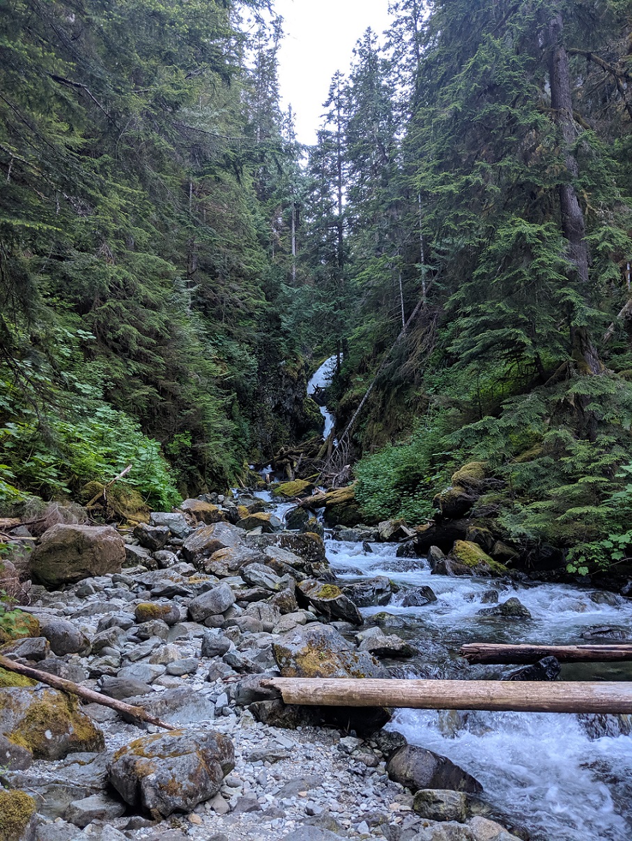
Get fresh water at Ipsut Falls.
The next day, just reverse the route. It's fun in the morning because it's 2000 ft and 20+ miles of downhill back to South Prairie and the Foothills Trail. If you want to take a different route back, you can take the trail northeast to Enumclaw, head to Black Diamond and take the trails to Maple Valley, then follow the Cedar River Trail back to Renton. It's a little longer and hillier, but much more scenic than the Interurban Trail.